Courses

Course Catalog
  • The GIS Foundations courses are designed to teach the basics of GIS using ESRI ArcGIS. These classes are taught using lectures, demonstrations and hands-on exercises. Class material focuses on a technical approach, light in theory, to get students up and running with ArcGIS quickly.

  • GIS Foundations I: Introduction to GIS - This course is designed to introduce the fundamental concepts of geographic information systems, demonstrate their use and value, and provide practical skills which can be directly applied to the work environment.
  • Prerequisite: Students are strongly encouraged to have basic computer operations knowledge, file management etc.

  • GIS Foundations II: GIS Basics - This course is designed to provide an overview of the basic building components for an effective and useful GIS. The course focuses on best practices for building a functioning GIS topics cover databases and tables, querying and selection processes, basic analysis tools, and the basics of editing.
  • Prerequisite: Students are strongly encouraged to have basic GIS skills, or the GIS Foundations I course.

  • GIS Foundations III: Advanced Editing - This course is designed to introduce the geodatabase structure and tools used to create and edit it. This course also introduces editing using topology.
  • Prerequisite: Students are strongly encouraged to have experience using GIS.

  • ArcGIS Pro: This course is designed for professionals who have experience working with ArcMap and would like to transition to ArcGIS Pro. In this course, you will learn to migrate ArcMap documents to ArcGIS Pro projects, work with and symbolize data, create map layouts, create 3D scenes, publish maps to ArcGIS Online from ArcGIS Pro, perform spatial analysis, and use ArcGIS ModelBuilder.

  • Prerequisite: Students are strongly encouraged to have experience using GIS.

  • ArcGIS Online: This course is designed for professionals who have prior experience with desktop GIS and would like to learn more about web GIS. In this course, you will learn to manage ArcGIS Online organizational accounts, connect to data services, publish your own data, symbolize data and pop-ups, make apps using templates and ArcGIS Web AppBuilder, and make mobile apps for data collection.

  • Prerequisite: Students are strongly encouraged to have experience using GIS.

Course Costs
Course Cost Duration
GIS Foundations $150Per Day (3 Day)
Transition to ArcGIS Pro $150Per Day (2 Day)
Web GIS with ArcGIS Online $150Per Day (2 Day)
All classes must have a minimum enrollment of eight people. Course prices may change, depending upon the course and sponsorship. WVAGP sponsored courses may have membership discounts. Group discounts may be available to organizations who schedule their own training, contact the WVGISTC for more information. A certificate will be awarded upon completion of the training.
Course Schedule
-->
Date Course Facility Register
5/24/2021 Transition to ArcGIS Pro Day 1 Online! Register Now!
5/25/2021 Transition to ArcGIS Pro Day 2 Online! Register Now!
5/26/2021 Web GIS With ArcGIS Online Day 1 Online! Register Now!
5/27/2021 Web GIS With ArcGIS Online Day 2 Online! Register Now!

GIS Training

The WV GIS Technical Center provides training and technical services that support the development and operation of GIS in West Virginia. In addition to our in-house training courses, we work with outside GIS instructors to promote GIS education in West Virginia. If you are an instructor and would be interested in training at our facility, please contact the WVGISTC training coordinator Kevin Kuhn.

If you are interested in a training course not listed in our catalog or schedule, please contact us!

For all other questions regarding our course offerings, please contact the Tech Center Training Coordinator at [email protected]

Note: ESRI has ended it's Certified Training Program; all future ESRI courses hosted by WVGISTC will be taught by ESRI instructors and can no longer be offered at a discounted rate.

Our Facilities

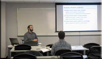
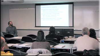
Courses taught at WVU are offered in a comfortable, state of the art teaching lab featuring 25 workstations loaded with the latest GIS software packages from a host of vendors. Each workstation has access to a shared drive, and is equipped with a high speed internet connection. Our classroom is equiped with an instructor station, overhead projector and large white board for easy viewing of lecture materials.